Mastabat al-Fir'aun
Virtual asset linked to this landmark

- Virtual owner
- The platform
- Times sold
- 0
- Fame on Wikipedia
- 6,835 article reads in 12 months
- Searches (30 days)
- 0
- Watching
- 0
Virtual ownership only. It gives no legal, financial or physical right in the real landmark. Prices are set by the market and may fall.
About Mastabat al-Fir'aun and its history
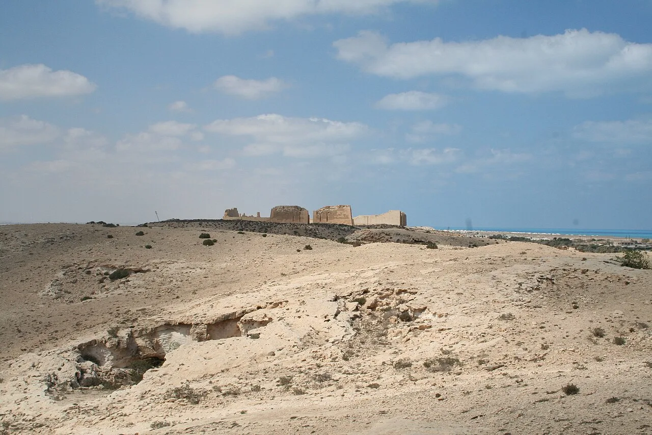
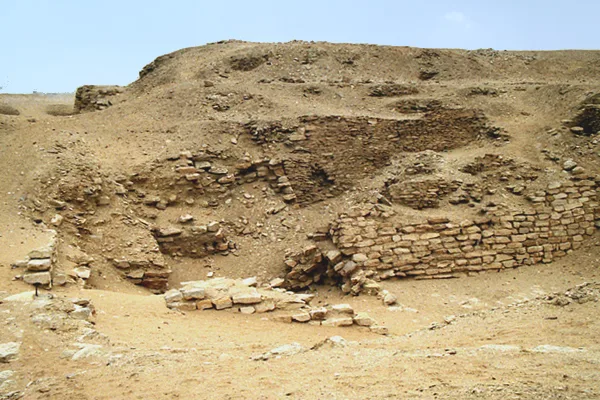
The tomb of Shepseskaf, last king of the Fourth Dynasty, at South Saqqara, built as a huge mastaba rather than a pyramid.
The Mastabat al-Fir'aun (Arabic: مصطبة الفرعون, romanized: Maṣṭabat al-Firʿawn, also referred to in Egyptological literature as the Mastaba el-Faraun, Mastabat el-Faraun or Mastabat Faraun, and meaning "Bench of the Pharaoh") is the grave monument of the ancient Egyptian king Shepseskaf (reign c. 2510–2503 BC), the last king of the Fourth Dynasty documented to date. It is located in South Saqqara halfway between the Pyramid of Djoser at Saqqara and the pyramids of Sneferu, the founder of the Fourth Dynasty, at Dahshur. The structure is located close to the pyramid of Pepi II, a ruler of the Sixth Dynasty. The stone quarry for the structure is located west of the Red Pyramid of Sneferu.
Discovery
The Mastabat al-Fir’aun was described for the first time by John Perring in the middle of the 19th century. Karl Richard Lepsius also sought out the tomb, but he did not carry out any close investigation. The first investigation of the subterranean parts of the structure was carried out by Auguste Mariette in 1858. A proper excavation of the whole tomb complex was first undertaken by Gustave Jéquier in 1924 or 1925. He was also the first to assign the structure to Shepseskaf, as a result of the discovery of a fragment of a stele. Before this, the tomb had erroneously been assigned to Unas, the last ruler of the Fifth Dynasty.
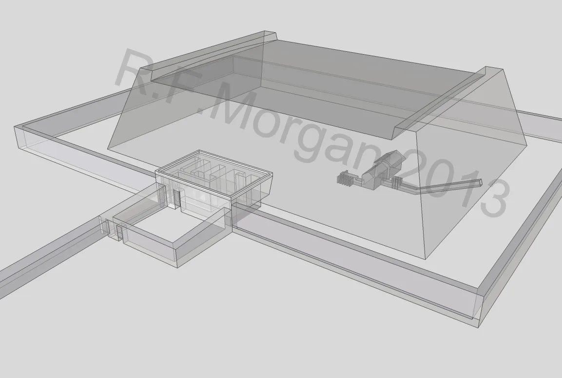
The mastaba is 99.6 metres long and 74.4 metres wide. It is around 18 metres high and the sides have an incline of about 70°. For the core structure, the same red sandstone was used as in the nearby Red Pyramid of Sneferu. Only very sparse traces of the outer cladding remain today, but from these it can be concluded that the lowest layer was clad in pink granite and all other layers were clad in Tura limestone.
Substructure
The entrance to the subterranean system of chambers is located on the shorter, northern side. A passage with a slope of 23°30′ leads down into the ground. It was originally 20.75 metres long, but due to a collapse it is now only 16.3 metres long. After this descent, the passage continues on the horizontal. This portion forms a small chamber with a length of 2.67 metres and a height of 2 metres. After this chamber, three portcullis stones are still anchored in the ceiling. At this point the passage is 1.1 metres wide and its height decreases to 1.27 metres. The walls and ceiling are clad in granite. After the portcullis stones, the height of the passage increases again, but the floor is very uneven, since it was no longer plastered. After a further reduction of height to 1.2 metres and a total length of 19.46 metres, the horizontal passage finally reaches the ante-chamber.
The ante-chamber has an east–west length of 8.31 metres, a width of 3.05 metres and a height of 5.55 metres. It has a pointed roof made of granite. A 1.2 m-high (3.9 ft), 1.11 m-wide (3.6 ft) and 1.54 m-long (5.1 ft) passage with a slope of 10°30′ extends from its western end, leading to the burial chamber.
Information source: Wikipedia · rewritten and edited by Maalem; available under CC BY-SA 4.0
- Location
- Giza, Egypt
- Coordinates
- 29.8389, 31.2153
- Category
- Ancient Sites
Source: Wikipedia · Factual information about the real landmark; unrelated to virtual ownership.
Price & ownership history
Landmarks near Mastabat al-Fir'aun
Map → Available
📖 9 K reads
Available
📖 9 K reads
 Available
📖 9 K reads
Available
📖 9 K reads
 Available
📖 17 K reads
Available
📖 17 K reads
 Available
📖 4 K reads
Available
📖 4 K reads