New Cairo
Virtual asset linked to this landmark

- Virtual owner
- The platform
- Times sold
- 0
- Fame on Wikipedia
- 89,092 article reads in 12 months
- Searches (30 days)
- 0
- Watching
- 0
Virtual ownership only. It gives no legal, financial or physical right in the real landmark. Prices are set by the market and may fall.
About New Cairo and its history
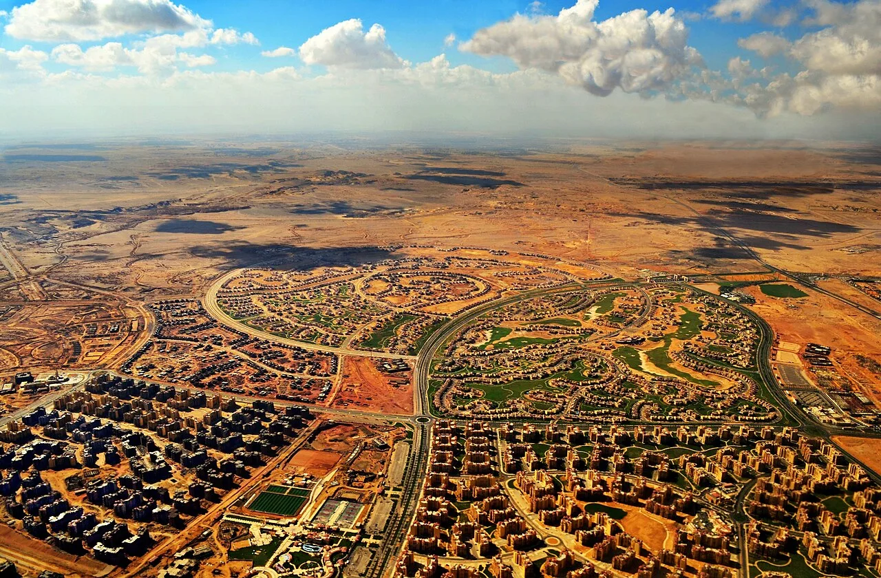
A planned city east of Cairo.
New Cairo is a modern satellite city within the Cairo Governorate of Egypt and the metropolitan area of Greater Cairo, whose formation was first initiated by a presidential decree in 1995 during the presidency of former Egyptian President Hosni Mubarak.
Administratively, it is officially part of the Eastern Area of Cairo city, but like all new settlements in Egypt, it is directly governed by the New Urban Communities Authority (NUCA).
The city was established in 2000 as part of Egypt's strategic effort to alleviate the chronic congestion of Greater Cairo by decentralising population and economic activity. As of 2024, New Cairo covered 99,814 acres (40,393 Ha), and is made up of a mix of residential neighbourhoods, commercial centres, and institutional zones. It is home to several gated communities, private universities, malls, international schools, and corporate headquarters, positioning it as a hub for Cairo’s upper and elite classes. Its development reflects Egypt’s broader neoliberal urban planning strategies, aimed at attracting private investments and promoting modern and western lifestyles.
According to the 2017 census, New Cairo's three qisms (police districts) had a combined population of 297,387 residents (also see population section below). The city could eventually host a population of 5 million. When compared to 6th of October, also built with the hopes of alleviating the strain on Cairo, more homes are being rented out in New Cairo. New Cairo has attracted both praise and criticism. While it is seen as a model for modern urban expansion, it is also scrutinised for social exclusivity and limited accessibility for lower-income classes.
History
After the 1952 revolution, in which the pro-Western monarchy was overthrown fuelled by Egyptian nationalism, a new urban vision emerged to symbolise the passing of the colonial era. The new republic established Gamal Abdel Nasser as its president, who created public spaces such as the Nile corniche to reclaim Cairo from its colonial past. Cairo’s landscape underwent great transformations as the government, undertook large-scale socialist housing projects to provide affordable housing to the newly arrived masses from the countryside seeking job opportunities. However, as the demographic grew rapidly as a result of industrialisation, the government struggled to control the growth and expansion of the city.
As the population continued to grow throughout the late 50s, rising land prices pushed lower- and middle Egyptians to settle informally on the outskirt of Cairo, into the desert onto privately owned agricultural land without official authorisation due to their affordability. This trend accelerated, and by 1990 the informal settlements housed nearly two-thirds of Cairo’s population. Despite their significance, successive governments largely overlooked these districts.
Information source: Wikipedia · rewritten and edited by Maalem; available under CC BY-SA 4.0
- Location
- Cairo, Egypt
- Coordinates
- 30.0300, 31.4700
- Category
- Districts, Streets & Markets
Source: Wikipedia · Factual information about the real landmark; unrelated to virtual ownership.
Price & ownership history
Landmarks near New Cairo
Map → Available
📖 4 K reads
Available
📖 4 K reads
 Available
📖 17 K reads
Available
📖 17 K reads
 Available
📖 84 K reads
Available
📖 84 K reads
 Available
📖 1 K reads
Available
📖 1 K reads