El Kab
Virtual asset linked to this landmark

- Virtual owner
- The platform
- Times sold
- 0
- Fame on Wikipedia
- 1,666 article reads in 12 months
- Searches (30 days)
- 0
- Watching
- 0
Virtual ownership only. It gives no legal, financial or physical right in the real landmark. Prices are set by the market and may fall.
About El Kab and its history
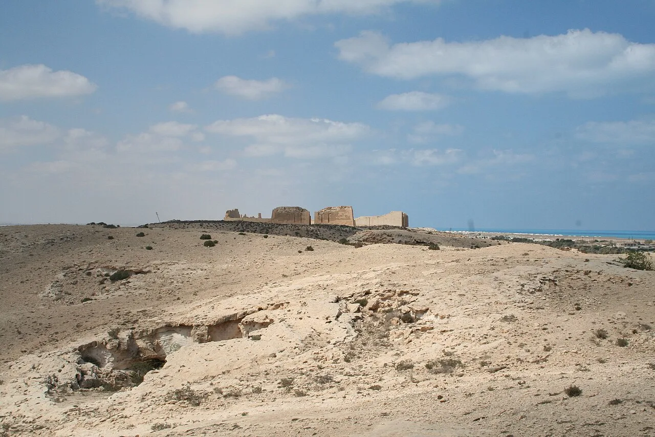
The site of ancient Nekheb on the east bank of the Nile north of Edfu, with huge mudbrick walls and rock-cut tombs.
Elkab, also spelled El-Kab or El Kab, is an Upper Egyptian site on the east bank of the Nile at the mouth of the Wadi Hillal about 80 kilometres (50 mi) south of Luxor (ancient Thebes). Elkab was called Nekheb in the Egyptian language (Coptic: ⲛ̀ⲭⲁⲃ enkhab, Late Coptic: [ənˈkɑb]), a name that refers to Nekhbet, the goddess depicted as a white vulture. In Greek it was called Eileithyias polis, "city of the goddess Eileithyia".
Elkab consists of prehistoric and ancient Egyptian settlements, rock-cut tombs of the early Eighteenth Dynasty (1550–1295 BC), remains of temples dating from the Early Dynastic period (3100–2686 BC) to the Ptolemaic Kingdom (332–30 BC), as well as part of the walls of a Coptic monastery. This site was first scientifically excavated by James Quibell at the end of the nineteenth century, but other archaeologists have spent time at this site include Frederick William Green, Archibald Henry Sayce, Joseph John Tylor, and Somers Clarke. However, Belgian archaeologists took over the project in 1937, and it has remained in their hands since then. Much of the research done at this site took place within the town enclosure of Elkab. However, since the 1980s the work has shifted more to the north and north east of the town.
Description of site
Elkab is in Upper Egypt, located on the east side of the Nile River, almost to the opposite of Hierakonpolis (on the other side of the river) and about fifty miles south of Thebes. With the way the river meandered and eroded the rocks and sand, the Nile River is almost level with the town, but according to Somers Clarke in his journal article “El-Kab and the Great Wall,” “in its early youth the town must have stood well above the flood waters.” The site could be described as a bay between sandstone cliffs to the north and south, and this same sandstone was used to build the temples found in this site.
Information source: Wikipedia · rewritten and edited by Maalem; available under CC BY-SA 4.0
- Location
- Aswan, Egypt
- Coordinates
- 25.1190, 32.7978
- Category
- Ancient Sites
Source: Wikipedia · Factual information about the real landmark; unrelated to virtual ownership.
Price & ownership history
Landmarks near El Kab
Map → Available
📖 14 K reads
Available
📖 14 K reads
 Available
📖 47 K reads
Available
📖 47 K reads
 Available
 Available
📖 8 K reads
Available
📖 8 K reads