Berenice Troglodytica
Virtual asset linked to this landmark

- Virtual owner
- The platform
- Times sold
- 0
- Fame on Wikipedia
- 33,593 article reads in 12 months
- Searches (30 days)
- 0
- Watching
- 0
Virtual ownership only. It gives no legal, financial or physical right in the real landmark. Prices are set by the market and may fall.
About Berenice Troglodytica and its history
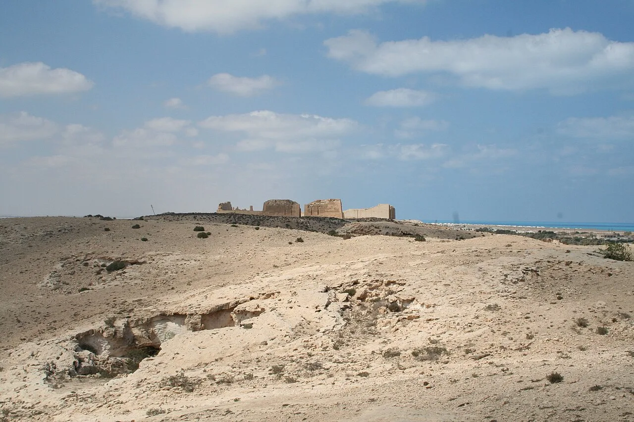
Ruins of a Red Sea port founded by Ptolemy II in 275 BC and named after his mother, later a hub of trade with India.
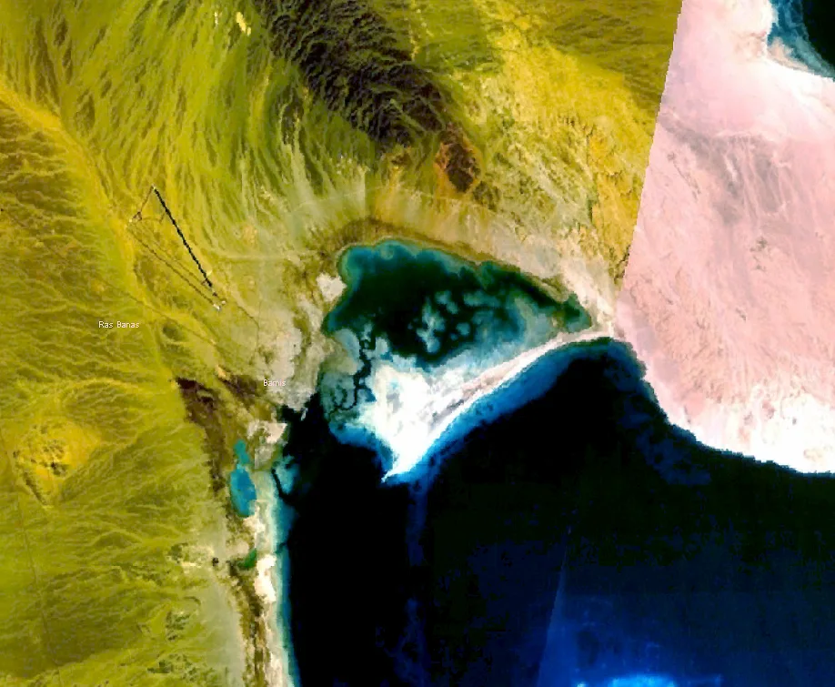
Berenice Troglodytica, also called Berenike (Greek: Βερενίκη) or Baranis, is an ancient seaport of Egypt on the western shore of the Red Sea. It is situated about 825 km south of Suez, 260 km east of Aswan in Upper Egypt and 140 km south of Marsa Alam.
It was founded in 275 BCE by Ptolemy II Philadelphus (285–246 BCE), who named it after his mother, Berenice I of Egypt.
A high mountain range runs along the African coast and separates the Nile Valley from the Red Sea; Berenice was sited upon a narrow rim of shore between the mountains and the Red Sea, at the head of the Sinus Immundus, a south-facing bay sheltered on the north by a high peninsula then called Lepte Extrema, and to the south by a chain of small islands scattered across the mouth of the bay. One of them was called the Island of Ophiodes (Ὀφιώδης νήσος) and was one of a few sources of gemstones local to Berenice. The harbour is marginal, but was improved by engineering.
Etymology
The name Troglodytica refers to the native people of the region, the "Troglodytai" or "cave dwellers". Although the name is attested by several ancient writers, the more ancient Ptolemaic inscriptions read Trogodytai, which Huntingford (1980) speculated could be derived from the same root as Tuareg. It is possible that later copyists confused this name with the more common term Troglodytai.
Berenice was prosperous and quite famous in antiquity. The city is noted by most ancient geographers, including Strabo, Pliny the Elder, and Stephanus of Byzantium. Its prosperity after the third century was mostly due to three reasons:
patronage by the Ptolemaic kings
safe anchorage
being at the eastern terminus of the main road from Upper Egypt.
The other terminus of that road is Coptos (now Qift), an Egyptian city on the Nile, which made Berenice and Myos Hormos the two main shipping centers for trade between Aethiopia and Egypt on the one hand, and Syria, Tamilakkam, and Tamraparni (ancient Sri Lanka) on the other. The road across the desert from Coptos was 258 Roman miles long, or 11 days' journey. Watering stations (Greek hydreumata, see Hadhramaut) were built along the road; the wells and resting places for caravans are listed by Pliny, and in the Itineraries.
In the 19th century Belzoni found traces of several of the watering stations.
Berenice was able to generate some commerce locally: The mines of Gebel Zabara and Mons Smaragdus at Wadi Sikait in the adjacent mountains, and the island of Ophiodes (now Zabargad Island) in the mouth of Berenice's harbor, were rich sources of gemstones (peridot?) at that time called “topaz” and “emerald”.
From the 1st century BCE until the 2nd century CE, Berenice was one of the critical way-stations for trade between the Indian subcontinent, Arabia, and Upper Egypt. It was connected to Antinoöpolis on the River Nile in Lower Egypt by the Via Hadriana in 137 CE.
Information source: Wikipedia · rewritten and edited by Maalem; available under CC BY-SA 4.0
- Location
- Marsa Alam, Egypt
- Coordinates
- 23.9106, 35.4739
- Category
- Ancient Sites
Source: Wikipedia · Factual information about the real landmark; unrelated to virtual ownership.